A common mistake we see in Northwest Arkansas is treating every cut slope as if it were solid limestone. Contractors working the hilly subdivisions east of College Avenue hit weathered shale that holds up fine during dry August grading, then slumps after the first heavy spring rain. Fayetteville sits on the Springfield Plateau, where the Boone Formation limestone interbeds with Chattanooga Shale — a material notorious for losing strength when saturated. Without a site-specific slope stability analysis, those thirty-foot cuts behind new homes become a liability the owner carries for years. Our team runs Spencer and Morgenstern-Price limit equilibrium models calibrated to ASTM D1586 SPT data collected from the same benches that will hold the slope, not borrowed from a report across town. For deeper investigation into bedrock depth and shear wave velocity, we combine the analysis with MASW surveys to map refusal surfaces, and when residual clays control the failure plane we pull undisturbed samples for triaxial testing to get drained strength parameters that actually represent field conditions.
A Fayetteville slope cut into weathered Chattanooga Shale that stands vertical in August can fail catastrophically by March — our analysis closes the gap between seasonal observation and long-term performance.
Scope of work in Fayetteville Arkansas
Live process video
Critical ground factors in Fayetteville Arkansas
The Boone-Chattanooga contact that runs through Fayetteville creates a classic wedge failure scenario: water infiltrates through fractured limestone, hits the relatively impermeable shale below, and builds pore pressure along the dip-slope bedding planes. We’ve mapped active landslides in the Kessler Mountain area where this exact mechanism displaced entire slope sections by several feet over a single winter. A developer who skips a proper slope stability analysis here isn’t just risking a surficial slough — they’re potentially activating a deep-seated failure that can undermine building pads, force foundation redesigns, trigger stop-work orders from the city engineer, and in the worst case result in litigation from downhill neighbors whose property lines shift. Washington County’s rapid growth means slopes that were pasture twenty years ago now have homes at the toe; the failure consequence classification automatically jumps to high-risk, and the required factor of safety increases accordingly. Our reports address this by documenting the consequence class, justifying the selected analysis parameters, and recommending monitoring if construction proceeds during wet months.
Our services
Slope stability analysis in Fayetteville spans far more than running a single software model. It starts with a site walk to map seeps and tension cracks, continues through targeted subsurface investigation, and ends with practical remediation options that a local excavator can actually build. Here is what the process looks like:
Site Reconnaissance and Geologic Mapping
We walk every slope before designing the investigation. Our geologist identifies seeps, existing scarps, and the Boone-Chattanooga contact exposure. This field mapping directly informs where we place borings and which cross-sections control the design.
Subsurface Investigation and Laboratory Testing
Borings extend below the potential failure surface — typically 1.5 times the slope height. We log per ASTM D2488, run SPTs at 2.5-foot intervals through the weathered zone, and send undisturbed Shelby tube samples for drained triaxial and ring shear testing on shale bedding planes.
Computational Slope Modeling
Using Slide2, SLOPE/W, or PLAXIS depending on the complexity, we model both rotational and translational failure modes. Each model layer gets its own Mohr-Coulomb or Hoek-Brown parameters. We iterate the water table position through seasonal extremes observed in Fayetteville’s rainfall records.
Remediation Design and Construction Oversight
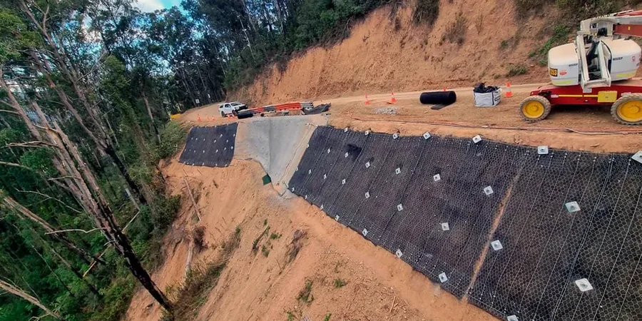
When factors of safety fall below code, we don’t just flag the problem — we design the fix. This may include slope flattening, subsurface drainage with horizontal wick drains, soil nailing with shotcrete facing, or reinforced earth berms at the toe. We stay involved during construction to confirm that excavation reveals the geology we modeled.
Common questions
What triggers a slope stability analysis requirement in Fayetteville?
The City of Fayetteville building department typically requires a slope stability analysis for any cut or fill exceeding 15 feet in height, or any slope steeper than 2H:1V that is within 50 feet of a structure or public right-of-way. The requirement is triggered during the grading permit stage. For subdivisions in mapped landslide-prone areas like the slopes around Mount Sequoyah, the requirement may apply even to shallower cuts. We coordinate directly with the city reviewer to align on the analysis scope before we start modeling.
How long does a slope stability study take from start to finish?
A typical timeline is three to five weeks: one week for the site walk and drilling subcontractor mobilization, one to two weeks for laboratory strength testing on the shale samples, and another week for the computational modeling and report drafting. If the slope shows inadequate factors of safety and we need to iterate a remediation design, add another week. Rush turnaround in two weeks is possible if the investigation is already complete and we’re only doing the analysis.
What is the cost range for a slope stability analysis in Northwest Arkansas?
For a typical single-slope analysis in Fayetteville with site investigation included, costs range from US$1,400 for a simple desktop review using existing boring data to US$3,910 for a full package with new borings, laboratory testing, multiple cross-section models, and a remediation design. The final cost depends on slope height, access constraints for the drill rig, and the number of cross-sections required to capture the geology.
Can you analyze slopes in the Chattanooga Shale specifically?
Yes — the Chattanooga Shale is the formation we work with most often in Fayetteville. We treat the weathered upper zone as a stiff fissured clay with drained friction angles typically between 18 and 24 degrees, and the unweathered shale as a weak rock with bedding plane shear strength determined by direct shear or tilt testing. The key parameter is the residual friction angle along pre-existing slickensided surfaces, which can be as low as 10 degrees. Our laboratory protocol specifically targets these planes for ring shear testing because they control the factor of safety more than any other variable.