Geotechnical investigation in Fayetteville, Arkansas, encompasses a suite of subsurface exploration methods designed to characterize soil, rock, and groundwater conditions before construction begins. This category covers everything from traditional soil borings and laboratory testing to advanced in‑situ techniques such as the Cone Penetration Test (CPT), which provides continuous real‑time data on soil stratigraphy and strength. In a city experiencing steady commercial and residential growth, understanding what lies beneath the surface is not just a regulatory formality—it is a critical step that protects structural integrity, controls project costs, and ensures public safety over the long term.
Fayetteville sits on the Springfield Plateau of the Ozark Highlands, where the near‑surface geology is dominated by alternating layers of limestone, shale, and residual clay derived from the weathering of the Boone and St. Joe formations. Karst features such as solution‑weathered bedrock, voids, and sinkholes are a well‑documented concern across Washington County. These conditions create variable bearing capacities, abrupt transitions between stiff rock and soft infill, and potential collapse hazards that standard split‑spoon sampling alone cannot always delineate. A properly scoped investigation must therefore integrate multiple techniques—rotary coring, test pits, and increasingly CPT profiling—to map rockhead depth and detect cavities that could undermine foundations or trigger subsidence.
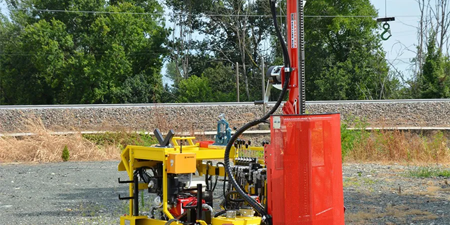
Regulatory compliance in Arkansas falls under the Arkansas State Board of Licensure for Professional Engineers and Professional Surveyors, which mandates that all geotechnical reports be prepared under the responsible charge of a licensed Professional Engineer. While the state does not publish a standalone geotechnical code, the 2018 Arkansas Fire Prevention Code (based on the IBC) and locally adopted amendments require site‑specific investigations that conform to standards such as ASTM D1586 for Standard Penetration Testing and ASTM D5778 for CPT. Fayetteville’s own building department enforces these references during plan review, and projects in karst‑prone zones may trigger additional review under the city’s hillside and drainage ordinances, making early‑phase investigation indispensable for permitting.
The types of projects that demand a thorough geotechnical investigation in Fayetteville range from single‑family residences on sloping lots to mid‑rise mixed‑use developments near the downtown district and institutional expansions on the University of Arkansas campus. Transportation infrastructure—road widenings, bridge replacements, and stormwater detention basins—also relies heavily on subsurface data to design stable embankments and foundation elements. Even smaller commercial additions benefit from targeted exploration: a CPT campaign can rapidly evaluate liquefaction potential and shallow foundation suitability on sites where soft alluvial clays overlie pinnacled bedrock, saving time and reducing the need for extensive borings. In every case, the investigation scope is tailored to the structural loads, site history, and geologic complexity identified during the desk‑study phase.
Available services
Common questions
What is the purpose of a geotechnical investigation in Fayetteville?
A geotechnical investigation identifies the subsurface soil, rock, and groundwater conditions at a site so engineers can design safe and economical foundations, retaining walls, and pavements. In Fayetteville’s karst terrain, the investigation is especially important for detecting limestone voids, irregular rockhead depths, and residual clays that can cause differential settlement or sinkhole collapse if not properly addressed during design.
How deep do geotechnical borings typically go for a commercial building in Northwest Arkansas?
Boring depth depends on foundation loads and geology, but for a typical commercial building in Fayetteville, borings often extend 20 to 40 feet below grade or until competent limestone bedrock is encountered. Where karst features are suspected, deeper rock coring or geophysical methods may be required to rule out voids beneath the planned bearing elevation, ensuring the foundation is supported on sound material.
What regulations govern geotechnical reporting in Arkansas?
Arkansas requires geotechnical reports to be prepared by a licensed Professional Engineer under the Arkansas State Board of Licensure. Although the state has no standalone geotechnical code, the adopted International Building Code and local Fayetteville amendments reference ASTM standards for drilling, sampling, and laboratory testing. The city may also enforce hillside development and drainage ordinances that demand site‑specific subsurface data.
How long does a typical geotechnical investigation take from field work to final report?
For a moderate‑sized project in Fayetteville, field work such as drilling, sampling, or CPT testing usually takes one to three days. Laboratory testing of soil and rock samples may require one to two additional weeks, and the final geotechnical report with foundation recommendations is typically delivered within three to four weeks after the field program, depending on the project’s complexity and the lab’s backlog.